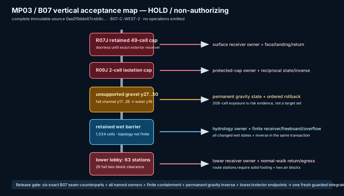
B07 vertical containment, gravity, and egress gate
The wet barrier, unsupported gravel, caps, lobby, and receivers are one integrated acceptance problem. No local fragment is released.
Current-source volume · 26 August 2026
These exact maps show the next acceptance boundaries for the Master Plan: containment, protected interfaces, route-use thresholds, ownership, and egress. They are additive evidence maps and do not claim a physical release.
Reading rule
Every map remains source-bound and default-deny until the required owners, receivers, reversibility, and scoped release checks have been accepted.
The wet barrier, unsupported gravel, caps, lobby, and receivers are one integrated acceptance problem. No local fragment is released.
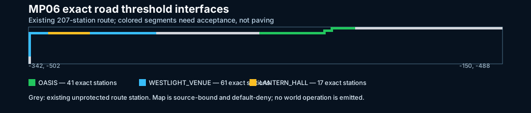
The 207-station route is already present; exact protected district thresholds need acceptance before any route-use survey, not paving.
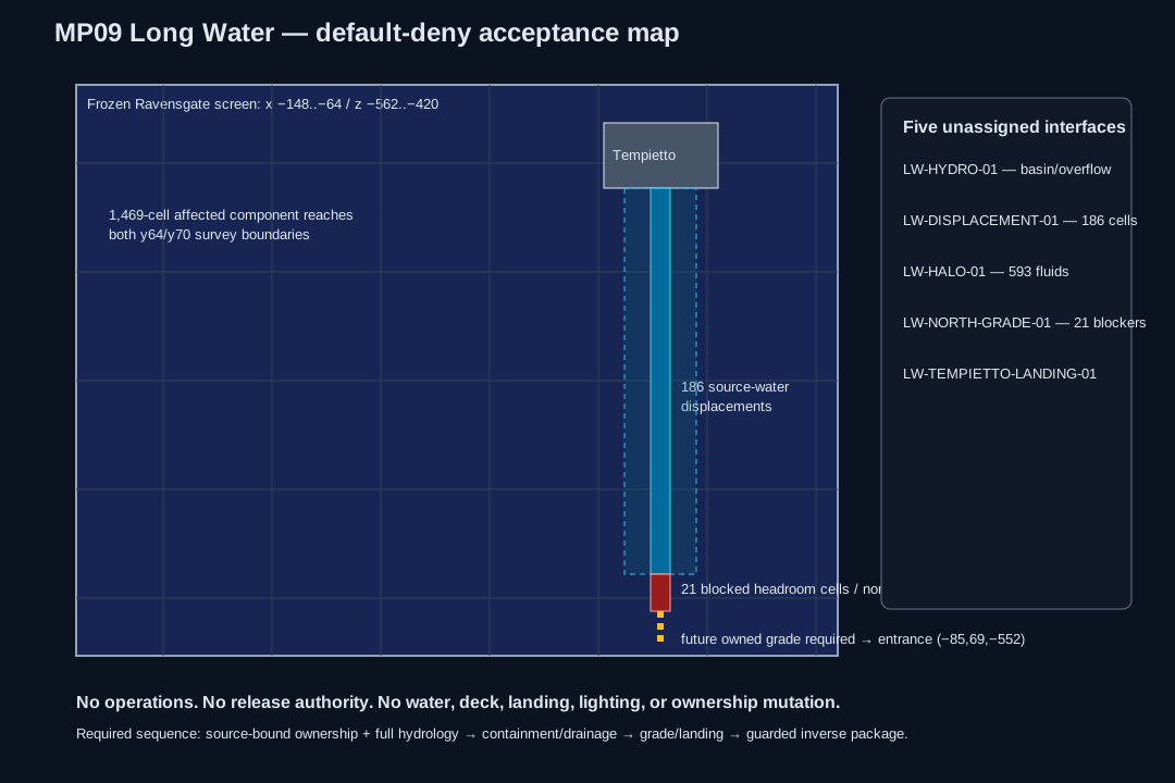
A vertically open fluid component prevents an isolated bridge, liner, or paving release until complete containment and receiver ownership exist.
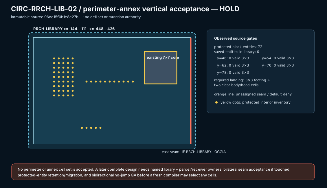
No valid 3×3 landing is present at the five transition levels; protected fixtures and the Library/Loggia seam remain default-deny.
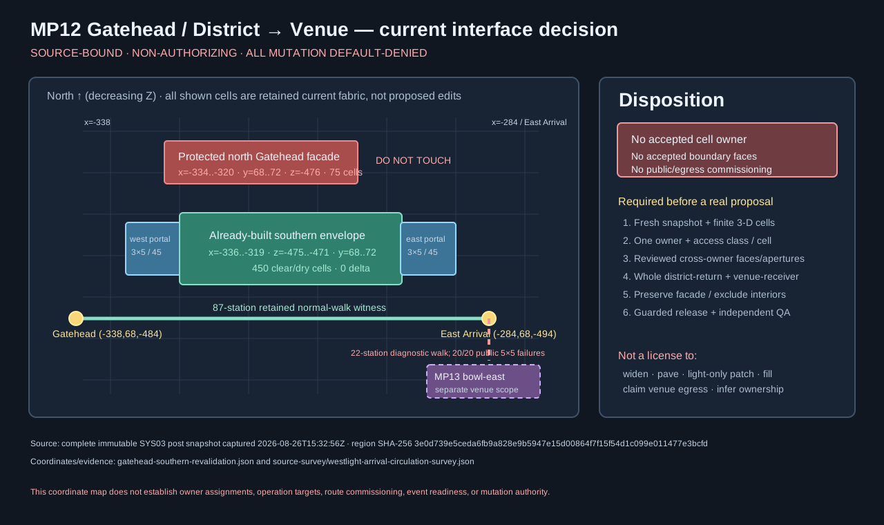
The southern alignment is already built; the north façade is protected and the remaining work belongs to a future district/venue access design.
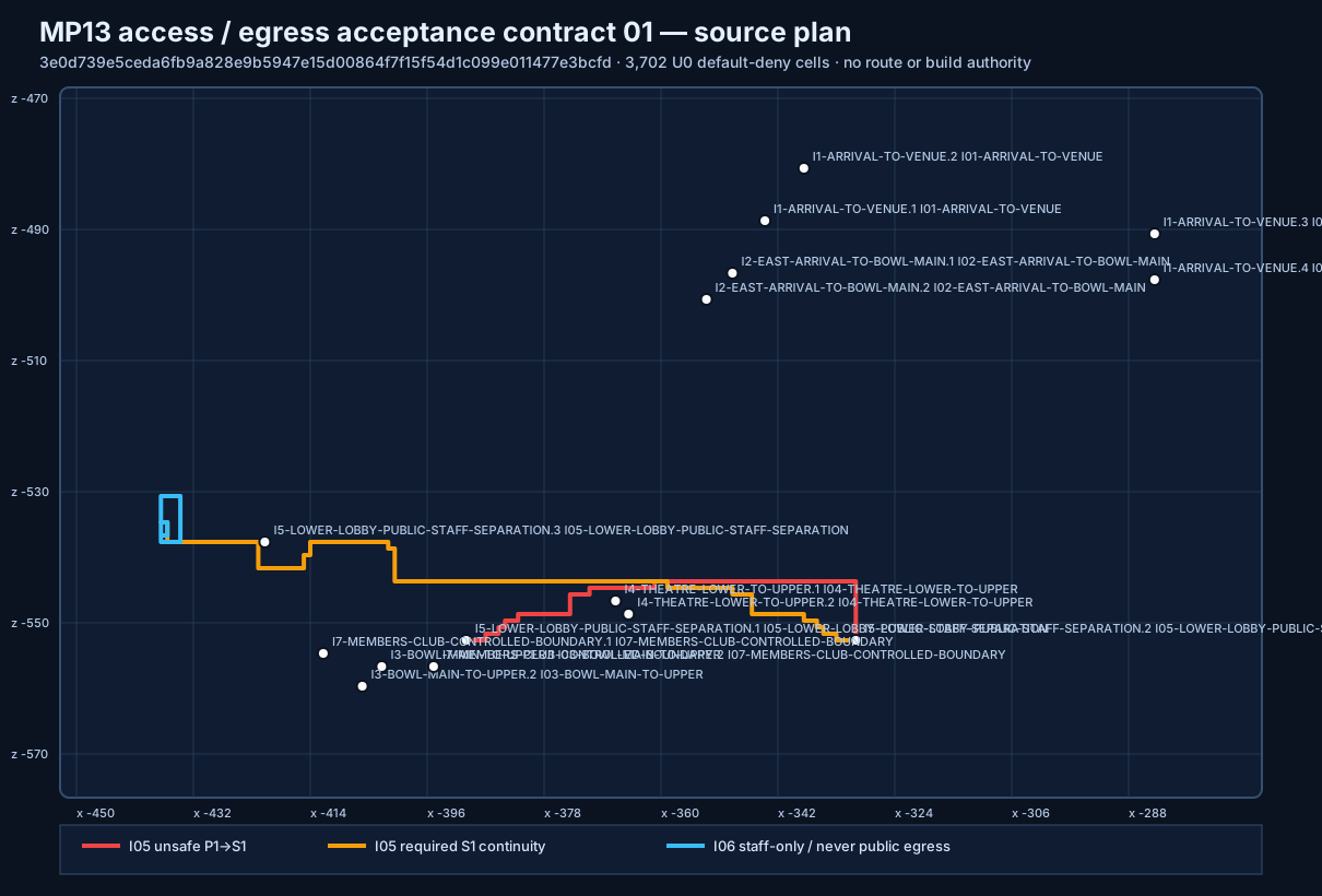
Every access-class cell and directional face remains unreviewed; the public-to-backstage path must be eliminated without breaking staff continuity.
Provenance
See the machine-readable manifest for original paths and SHA-256 values.